Monday, February 6, 2012
Quiet Week Expected
A quiet week is expected this week with a couple of dry cold fronts coming through, helping to knock back temperatures. The biggest question is what happens this weekend. A system will pass by to our south with marginally cool air available. If the storm decides to move up the coast, we could see a snow storm here in the foothills of North Carolina. Right now, the models continue to show the storm off the coast. We will keep you updated daily on the latest trends.
Sunday, February 5, 2012
Wedge Day Tomorrow, Sunny Skies, Then WINTER?
Tomorrow will feature a wedge that will help to keep skies mostly cloudy, a few patchy spots of drizzle, and will keep temperatures mainly in the 40s. Overnight, the flow will turn helping to break the clouds up, bring sunny skies for the rest of the week. Temperatures Tuesday, Wednesday, and Thursday will be in the upper 50s or lower 60s. Friday and Saturday will feature temperatures in the lower 50s ahead of our next possible system.
For the possibly exciting part of the forecast. Saturday, high latitude blocking is expected to occur in the western United States, sending a ridge towards the eastern United States. Temperatures are expected to remain fairly cool over the weekend, so the question is will there be any moisture available for snow. Well, the answer is maybe. Some of the operational computer models and a few ensembles are hinting at the possibility of winter weather on Sunday. The problems are in the phasing of the upper level trough and the surface system. The models typically do not handle phasing very well a few days out much in less seven days out. So, we will continue to watch the possibility for winter weather this upcoming weekend.
Below are pictures from the 18z run of the GFS computer model with explanation.
 |
| Above is the Precipitation amount on the GFS Sunday Morning. As you can see, there is light precipitation over western North Carolina. Most if not all of the precipitation would fall as snow, if the GFS was right. |
 |
| Above is the 500 mb map showing vorticity. As you can see, the northern and southern streams are separate. If the two streams phase together, a major system could develop on the east coast; however, it would be unclear where the system would track. If the two systems do not phase, there is a better chance of snow. |
Wednesday, February 1, 2012
Wednesday Weather Whys: Model Forecast
Have you ever wondered where the meteorologist receive weather data, models, and other sources of information? Well, below I explain where some of these products come from and where you can find the products that we meteorologist use:
MODELS
There are hundreds of sites to find model data; however, most of the data comes from NCEP, the National Center for Environmental Prediction. Below is a link to the model data that I use in many of my forecast. The GFS and NAM models can be found on this site, but that is not where it stops. Other models can also be found on this site.
http://mag.ncep.noaa.gov/NCOMAGWEB/appcontroller?prevpage=index&MainPage=index&cat=MODEL+GUIDANCE&page=MODEL+GUIDANCE
You can also find other models on other sites, such at the European model and the Canadian Model.
MODEL OUTPUTS
You can find direct model output predictions for your area at the website below:
http://wxweb.meteostar.com/
This website shows the actual GFS model output for a specific area.
Coming up next week, I will explain MOS data so you can predict the temperature in your area. If you have a question that you would like me to answer in the Wednesday Weather Whys section, just post the question below, and I will answer it here on the blog.
Monday, January 30, 2012
Small Chance of Showers Thursday, Heavier Rain Soon
After a few nice spring like days, our next system will begin approaching from the west. Right now, models are suggesting that the weather Thursday will feature cloudy skies and scattered light showers. The next big system appears to push into the area over the weekend. A lot of uncertainty accompanies this system; however, it appears very heavy rain could push over the area. We will keep you updated, but below is your three day forecast:
TUESDAY: Sunny with highs in the mid 60s and lows in the low 40s.
WEDNESDAY: Partly Cloudy with showers overnight. Highs in the mid 60s and lows in the upper 40s.
THURSDAY: 40% chance of light showers. Light accumulations. Highs in the mid 60s and lows in the upper 30s.
TUESDAY: Sunny with highs in the mid 60s and lows in the low 40s.
WEDNESDAY: Partly Cloudy with showers overnight. Highs in the mid 60s and lows in the upper 40s.
THURSDAY: 40% chance of light showers. Light accumulations. Highs in the mid 60s and lows in the upper 30s.
Thursday, January 26, 2012
Possible Strong to Severe Storms This Evening, Tonight

The Storm Prediction Center in Norman Oklahoma has the foothills of North Carolina in a slight risk for severe storms today. According to the SPC, the slight risk runs right through eastern Burke County through western Lincoln County. The other areas west of Hickory are in the threat for mainly non-severe storms; however, no guarantees can be made. Severe storms can occur outside of the threat area, and with the threat area so close, everyone needs to be sure to be ready for severe weather tonight. The strongest storms look to penetrate through the area between 9:00 p.m. Thursday and 1:00 a.m. Friday. These storms have a chance to produce very strong winds, small hail, heavy rain, lightning, and a slight chance of a tornado. Be sure to have your NOAA Weather Alert radio on tonight and keep in touch with the latest information from the NWS via television, radio, and/or the internet.
For more information, visit the Storm Prediction Page: http://spc.noaa.gov/products/outlook/day1otlk.html
Wednesday, January 25, 2012
No Real Cool Down Expected
Looking into the long range today, no real cool down is seen at least for next week. A front will push showers and thunderstorms through the area late Thursday evening and early Friday morning. Some areas could see over a half inch of rain from the system. The weekend will clear out nice with temperatures in the 50s right through the mid-week. Temperatures following this period could rise a little with another ridge building into the area. Its not looking to good for snow lovers through the first weeks of February, but you never know what the last couple weeks of February and the first couple weeks of March will have for the foothills of North Carolina.
Wednesday Weather Whys: Cold Air Damming
One of the most complex weather patterns in western North Carolina is cold air damming. This occurs when high pressure centers itself just offshore or onshore the coast of New England. Wind comes out of the northeast and banks itself up against the mountains. Cold air is transported from the Atlantic Ocean and from the north over the Carolinas. During many events, temperatures struggle to reach the mid-30s during the winter. In some cases, this can be the ingredient needed for an ice storm in western North Carolina. Low pressure rides up from the Gulf of Mexico and sends warm moist air up and over the cold air. The temperatures aloft are to warm for snow; however, the temperature at the ground is below freezing. This results in freezing rain or sleet falling from the clouds.

Wednesday, January 18, 2012
Wednesday Weather Whys: Mountain Upslope Snow
Many people ask me why the mountains receive more snow than we do here on the east side of the mountains. One of the reasons why the mountains receive more snow is due to uplsope snow behind low pressure systems. Upslope snow occurs when the wind blows out of the northwest. While most of us in the foothills remain dry and sunny with very cold temperatures, the mountains have very heavy snow. The winds hit the mountains and move upward, causing clouds to form and snow eventually develops. A few inches of snow can fall in a short amount of time, and the snow is usually accompanied with gusty winds. Every so often, we may see flurries outside of the mountains, and in very rare cases, snow can accumulate here in the foothills of North Carolina.
Sunday, January 15, 2012
Showers Possible Tuesday, Warm Up Coming Soon
Monday will feature increasing clouds with highs in the low 50s. A weak system will push through the area on Tuesday, bring showers and a slight chance of a thunderstorm. Highs Tuesday will be in the upper 50s. Lows Monday and Tuesday will be in the mid 30s. Wednesday and Thursday will be sunny and cool with highs in the mid to upper 40s and lows in the mid to upper 20s. A modest warm up will start next weekend, with temperatures Friday, Saturday, and Sunday increasing from the mid 50s Friday to the mid 60s Sunday.
Wednesday, January 11, 2012
Wednesday Weather Whys: Snow Above Freezing
A common question is how can it snow when the temperature is above freezing? This is a very complicated subject and a difficult question to answer. The concept is the wet bulb temperature. Basically, the air above the ground must be below 32 degrees; however, there is a very shallow layer of temperature at the ground above freezing. The air is not 100% saturated with moisture, so some of the snow is being evaporated into the air before it hits the ground. This evaporation is causing the air to cool, and the end result is the air temperature begins to cool. Eventually, the temperature will drop to freezing or the snow will change over to rain.
Tuesday, January 10, 2012
Flood Watch Issued, Heavy Rain Expected
Heavy rain is expected to develop over the region tonight and continue through the day Wednesday. The rain is expected to be the heaviest in the late morning, early afternoon hours. The National Weather Service is currently predicting around 2-3 inches of rain across the foothills and mountains of NC, with higher amounts along the southern mountains. Due to this heavy rain, the National Weather Service has issued a Flood Watch from midnight through Wednesday evening.
I expect that the foothills will receive between 1.5-2.5 inches of rain, with isolated higher amounts. A few convective cells could develop, causing locally higher rainfall totals. If a line of storms are able to develop, rainfall could approach three inches in some areas. The only good news about this much rain is that the system will be moving very quickly. The system should be pushing out of the area by Wednesday evening.
After this storm, nice conditions are expected throughout the weekend. Temperatures Thursday will be in the upper 50s; however, that will be the end of the warm temperatures. Temperatures Friday through the weekend will struggle to reach the mid 40s and lows are expected to be in the low 20s.
Flood Watch
FLOOD WATCH
NATIONAL WEATHER SERVICE GREENVILLE-SPARTANBURG SC
244 PM EST TUE JAN 10 2012

...HEAVY RAINFALL TO AFFECT THE SOUTHERN APPALACHIANS AND ADJACENT
FOOTHILLS TONIGHT THROUGH WEDNESDAY...

.A LOW PRESSURE SYSTEM OVER THE LOWER MISSISSIPPI RIVER VALLEY
LATE TODAY WILL TRACK NORTHEAST TOWARD THE SOUTHERN APPALACHIANS
THROUGH WEDNESDAY. HEAVY RAIN WILL DEVELOP AHEAD OF THIS SYSTEM
ACROSS THE WESTERN CAROLINAS AND NORTHEAST GEORGIA TONIGHT
THROUGH WEDNESDAY. SOUTHEAST FLOW AHEAD OF THE LOW WILL ENHANCE
RAINFALL TOTALS ALONG THE EASTERN ESCARPMENT OF THE SOUTHERN
APPALACHIANS...POSSIBLY PRODUCING FLOODING.

GAZ010-NCZ033-035-049-050-053-059-062>065-501>510-SCZ001>003-
111000-
/O.NEW.KGSP.FA.A.0001.120111T0500Z-120112T0500Z/
/00000.0.ER.000000T0000Z.000000T0000Z.000000T0000Z.OO/
RABUN-AVERY-ALEXANDER-YANCEY-MITCHELL-BUNCOMBE-NORTHERN JACKSON-
MACON-SOUTHERN JACKSON-TRANSYLVANIA-HENDERSON-CALDWELL MOUNTAINS-
GREATER CALDWELL-BURKE MOUNTAINS-GREATER BURKE-MCDOWELL MOUNTAINS-
EASTERN MCDOWELL-RUTHERFORD MOUNTAINS-GREATER RUTHERFORD-
POLK MOUNTAINS-EASTERN POLK-OCONEE MOUNTAINS-PICKENS MOUNTAINS-
GREENVILLE MOUNTAINS-
INCLUDING THE CITIES OF...CLAYTON...NEWLAND...SPRUCE PINE...
ASHEVILLE...SYLVA...FRANKLIN...BREVARD...HENDERSONVILLE...
LENOIR...MORGANTON...MARION...LAKE LURE...RUTHERFORD...COLUMBUS
244 PM EST TUE JAN 10 2012

...FLOOD WATCH IN EFFECT FROM MIDNIGHT EST TONIGHT THROUGH
WEDNESDAY EVENING...

THE NATIONAL WEATHER SERVICE IN GREENVILLE-SPARTANBURG HAS ISSUED
A

* FLOOD WATCH FOR PORTIONS OF NORTHEAST GEORGIA...WESTERN NORTH
  CAROLINA AND UPSTATE SOUTH CAROLINA...INCLUDING THE FOLLOWING
  AREAS...IN NORTHEAST GEORGIA...RABUN. IN WESTERN NORTH
  CAROLINA...ALEXANDER...AVERY...BURKE MOUNTAINS...BUNCOMBE...
  CALDWELL MOUNTAINS...EASTERN MCDOWELL...EASTERN POLK...
  GREATER BURKE...GREATER CALDWELL...GREATER RUTHERFORD...
  HENDERSON...MCDOWELL MOUNTAINS...MACON...MITCHELL...NORTHERN
  JACKSON...POLK MOUNTAINS...RUTHERFORD MOUNTAINS...SOUTHERN
  JACKSON...TRANSYLVANIA AND YANCEY. IN UPSTATE SOUTH CAROLINA...
  GREENVILLE MOUNTAINS...OCONEE MOUNTAINS AND PICKENS MOUNTAINS.

* FROM MIDNIGHT EST TONIGHT THROUGH WEDNESDAY EVENING

* HEAVY RAINFALL WILL DEVELOP AHEAD OF A LOW PRESSURE SYSTEM
  MOVING NORTHEAST FROM THE LOWER MISSISSIPPI RIVER VALLEY TO WEST
  OF THE SOUTHERN APPALACHIANS. SOUTHEASTERLY UPSLOPE WINDS AHEAD
  OF THIS SYSTEM WILL ENHANCE PRECIPITATION ALONG THE EASTERN
  SLOPES OF THE MOUNTAINS AND THE IMMEDIATELY ADJACENT FOOTHILLS.
  RAINFALL TOTALS OF 2 TO 3 INCHES ARE LIKELY IN THE WATCH
  AREA...WITH ISOLATED AMOUNTS BETWEEN 3 AND 4 INCHES IN THE
  SOUTHERN MOUNTAINS.

* THE HEAVY RAINFALL WILL CREATE SIGNIFICANT RISES ON AREA RIVERS
  AND STREAMS. SOME OF THESE TRIBUTARIES COULD EXCEED BANKFULL AND
  FLOOD NEARBY ROADWAYS ON WEDNESDAY. FLOODING WILL ALSO BE
  POSSIBLE ALONG MAIN STEM RIVERS...ESPECIALLY THE UPPER REACHES
  OF THE FRENCH BROAD RIVER WEDNESDAY AFTERNOON OR EVENING.

PRECAUTIONARY/PREPAREDNESS ACTIONS...

A FLOOD WATCH MEANS THERE IS A POTENTIAL FOR FLOODING BASED ON
CURRENT FORECASTS. YOU SHOULD MONITOR LATER FORECASTS AND BE
ALERT FOR POSSIBLE FLOOD WARNINGS. THOSE LIVING IN AREAS PRONE TO
FLOODING SHOULD BE PREPARED TO TAKE ACTION SHOULD FLOODING
DEVELOP.

&&

$$

GERAPETRITIS
Sunday, January 8, 2012
Unsettled Weather To Continue
The first part of this week will be characterized by the unsettled weather that is expected. A system Monday will bring a 50% chance of showers throughout the day; however, light precipitation is expected. Most areas will receive under a tenth of an inch of rain Monday. Highs will be in the low to mid 50s, and the low Monday night will be in the mid 30s.
Tuesday will be a sunny day with clouds building late in the day. High: 60, Low: 45
Wednesday is expected to be the wetter of the two days. Wednesday will feature an area of low pressure tracking near the region bringing good lift and a period of moderate to heavy rain. Right now, it appears we will not have to worry about severe weather. The chance of rain Wednesday is 85%. It appears most areas will receive over a half of an inch of rain. The high is expected to be in the low 50s, and the low Wednesday night will be in the low 40s.
Thursday may feature a few left over showers; however, the rest of the week and weekend will feature cooler temperatures. Temperatures Friday-Sunday are expected to drop into the 40s for highs and 20s for lows.
Thursday, January 5, 2012
Colder Weather May Be Coming Soon
As we move later into the month of January, we are beginning to see indications that cold air could be moving back into western North Carolina.
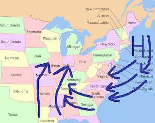
The Arctic Oscillation, one of the main factors used to help determine if cold air will move out of the Arctic towards lower latitudes, is beginning to turn negative. A negative AO means colder weather is more likely here in the foothills of western NC. Right now, indications are that the AO will go negative.
Now, this does not necessarily mean snow will find its way to western North Carolina. Other factors are very important in forecasting snow here in North Carolina; however, it looks like the atmosphere will remain relatively cool.
The other factors that forecasters and meteorologist look at is the Pacific North America Pattern (PNA), and the North Atlantic Oscillation (NAO). What the PNA and NAO does will affect our pattern here in WNC also. Right now, it appears the NAO and PNA are returning to a neutral state next week. There is very little certainty what will occur in the following weeks; however, a major storm late next week could help to flip the NAO and PNA to favorable phases for WNC.
The pattern is loaded with energy. Anything is possible as we move later into this month and into February. Right now, it appears colder weather will move into the area Thursday or Friday next week with a major storm. Temperatures will be similar to the previous cold weather outbreak. After this system, the models begin to diverge; however, the cooler weather appears to be heading back north for a few days before returning fairly quickly.
Always check here on the North Carolina Foothills Weather blog for the latest information.
Wednesday, January 4, 2012
Wednesday Weather Whys: The Difference Between Winter Precipitation
New this year is the Wednesday Weather Whys here on North Carolina Foothills Weather. This week we will look at the different forms of precipitation in the winter time. There are four basic precipitation types we can get in the winter: Rain, Snow, Sleet, and/or Freezing Rain. Each one happens different here in western North Carolina, so lets look at the different situations where these events occur here in western North Carolina.
The pictures below are from the National Weather Service. North Carolina Foothills Weather is not associated with the NWS. To view the page that these pictures are from, Click Here.
Freezing Rain

Freezing rain occurs when the temperature through a substantial part of the atmosphere is above freezing; however, the temperature right at the ground is below freezing. The rain will freeze on contact on objects, glazing the objects with a coat of ice.
Sleet

Sleet occurs when there is small layer of above freezing temperature in the atmosphere. This layer melts the snow; however, the drop enters back into a subfreezing region and re-freezes into a sleet pellet. Once a snowflake is melted, it will never be a snowflake again.
Snow

In order for snow to fall, the entire layer of the atmosphere must be at or below 32 degrees Fahrenheit. There are exceptions to the rule that will be explained next week when we look at the wet bulb temperature. Check back next week to see how the wet bulb temperature can affect winter weather.
The pictures below are from the National Weather Service. North Carolina Foothills Weather is not associated with the NWS. To view the page that these pictures are from, Click Here.
Freezing Rain
Freezing rain occurs when the temperature through a substantial part of the atmosphere is above freezing; however, the temperature right at the ground is below freezing. The rain will freeze on contact on objects, glazing the objects with a coat of ice.
Sleet
Sleet occurs when there is small layer of above freezing temperature in the atmosphere. This layer melts the snow; however, the drop enters back into a subfreezing region and re-freezes into a sleet pellet. Once a snowflake is melted, it will never be a snowflake again.
Snow
In order for snow to fall, the entire layer of the atmosphere must be at or below 32 degrees Fahrenheit. There are exceptions to the rule that will be explained next week when we look at the wet bulb temperature. Check back next week to see how the wet bulb temperature can affect winter weather.
Tuesday, January 3, 2012
Warm-Up Begins Tomorrow
After temperatures struggle to reach the mid-30s today, a modest warm-up will begin tomorrow. Temperatures tonight will drop into the upper teens or lower 20s. Temperatures Wednesday will remain below average near the mid-40s; however, the temperature Thursday will climb into the mid-50s and low 60s Friday. Lows at night will range from the upper 20s on Wednesday and Thursday Night and lows around 40 Friday Night. A system will then make a run towards the region Saturday evening or Sunday morning that is expected to bring rain to everyone including the mountain counties. Temperatures Saturday, Sunday, and Monday are expected to remain in the upper 50s or lower 60s.
In the long range, temperatures are expected to remain fairly mild in the 50s or 60s for next week with another system possible by mid to late next week.
In the long range, temperatures are expected to remain fairly mild in the 50s or 60s for next week with another system possible by mid to late next week.
Sunday, January 1, 2012
Cooler Weather Rings in New Year
A warm day today will quickly be replaced by an Arctic outbreak. A cold front is going to pass through the region this afternoon and bring in an Arctic airmass. The high temperatures on Monday is expected to climb to the mid 40s with a gusty northwest wind around 10-15 mph with gust as high as 30 mph. Monday Night the temperature will drop to near 20 degrees. Tuesday will be the coldest day with the temperature climbing to the mid 30s and with lows near 20 degrees. Wednesday will start the warm-up with temperatures in the mid 40s. Thursday will feature temperatures around 50, and Friday will have temperatures in the mid 50s. No rain is expected this week; however, a few flurries are possible outside the mountains. The mountains is expected to pick up a few inches of snow from this event.
Subscribe to:
Comments (Atom)